
What is it?
John Muir, although a controversial figure, busts it down best: “It is by far the grandest of all the special temples of Nature I was ever permitted to enter”
The Ridley Review:
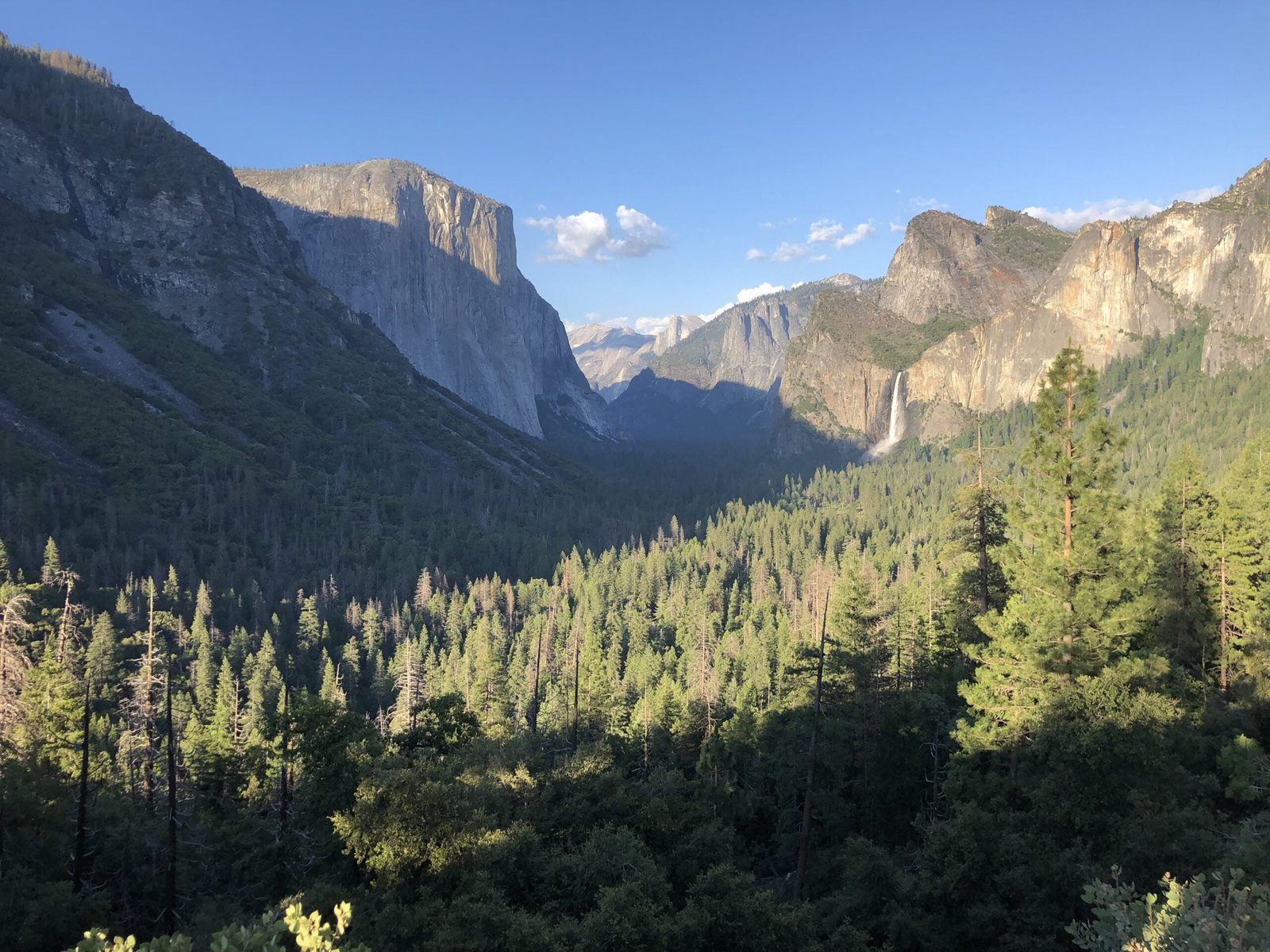
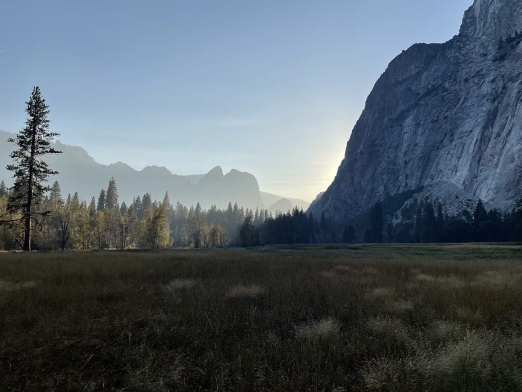
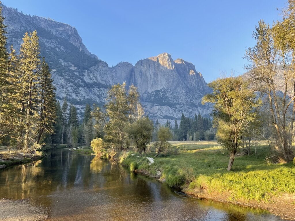
Wow! That is, with 99% likelihood, your reaction upon first entering Yosemite Valley. The pictures don’t do justice to the sheer size of this bad boy. The granite walls are HUGE! Can’t-see-the-top-through-car-windows huge. It looks like something out of a fantasy: the meadows, Merced River, steep peaks, fresh-smelling pines, and flowing meadows. You need to have your head on a swivel just to take it all in.
No joke, this is the most beautiful place I’ve ever seen. It’s insane in all your membranes.
Yosemite Valley
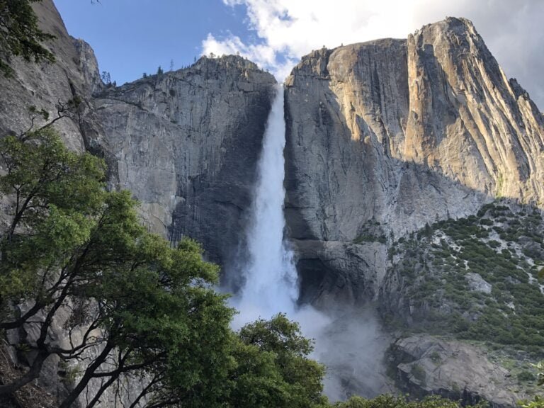
What you get once you find parking (they call it Yosemite National Parking Lot for a reason!) is that you really do get to choose your own adventure. If you want a relaxing time, take the free shuttle bus around the Valley floor, stop by the visitor center which houses some nice exhibits on the history of the park, or take a leisurely stroll through the meadows using Cook’s Meadow Loop or the Valley Loop Trail. Check out Lower Yosemite Falls – it is right near the visitor center, and is entirely flat, paved, and accessible, getting you up close and personal with the tallest waterfall in North America. More adventurous guests can tackle one of the longer day hikes out of the Valley to one of many incredible vantage points. The Valley is also a climber’s paradise, if that is your speed.
The Valley has a lot of food and lodging options. It even, hilariously, had a Starbucks for a couple of years that has now been replaced by a Peet’s Coffee, a local California brand. For both there are cheap options (camping and groceries or grab-and-go sandwiches) or luxury options (the Ahwahnee Inn and its fine dining establishment). Gas is available at several points in the park, but not Yosemite Valley so plan accordingly.
Other Regions
Although most visitors (including this writer) tend to stick to Yosemite Valley, the park is so much bigger than that. Another popular area is Mariposa Grove and Wawona, at the Southwestern edge of the park. This section is home to several groves of massive Sequoia trees, including the one that you’ve probably seen that has a trail leading right through its hollowed-out trunk. Here you also find some odd features unique to Yosemite because they got grandfathered in: tennis courts and a 9-golf course. While definitely looked upon disdainfully by purists, this just adds to charm this park has. There are also lodging, camping, and food options in this section of the park.
Up in the Northwest (and hottest) corner of the park we find Hetch Hetchy Valley. What was once a valley equal in size and beauty to Yosemite Valley is now, controversially, a reservoir. This post goes into greater detail about the history behind O’Shaughnessy Dam, but for now this part of the park is under water. It does have hiking trails along the dam and sides of the walls, and in Spring and Summer still has several impressive waterfalls, Wapama Falls the most famous and accessible. Backpacking is a common activity here.
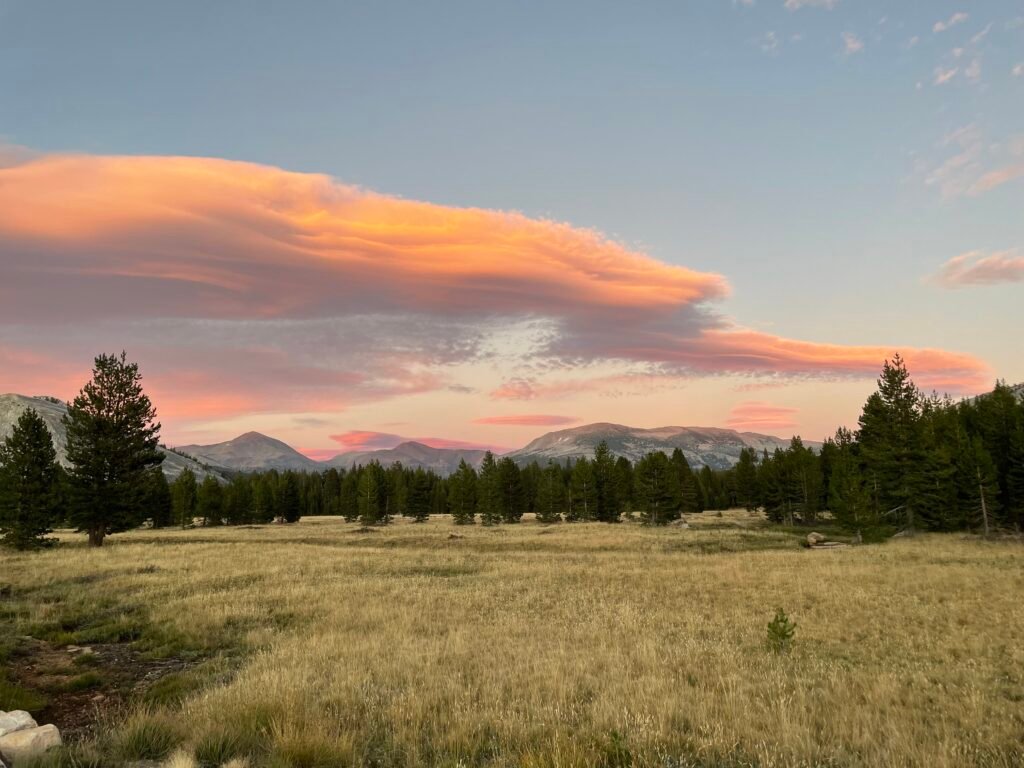
Run horizontally across the northern section of the park is the Tioga Road, a road only open for a couple of months of the year due to snow and the parks only Eastern entrance. This road provides access to the Tuolumne Meadows section of the park, a series of meadows, lakes, and streams at high elevation. There is camping and hiking available here, without much fewer amenities.
Yosemite is deceptively huge – getting from one section of the park to another takes a long time on winding, narrow road. Driving to Glacier Point from the Valley takes about 60 minutes in total. It will take around an hour to get to Hetch Hetchy, Mariposa, or deep into the Tioga Road from Yosemite Valley. The Valley itself is about 30 minutes from the closest entrance, Arch Rock/Highway 140.
Roads and Gas
Roads into the park are: highways 120 and 140 from the West, highway 41 from the South, and highway 120 from the East. Hetch Hetchy has a separate entrance near Mather. The section of 120 that crosses the park horizontally, called the Tioga Road, is closed due to snow for much of the year; usually between November – May/June. Roads in the park lead to Mariposa Grove/Wawona, Glacier Point, Yosemite Valley, Hetch Hetchy, and Tuolumne Meadows. Gas is available outside the Eastern Tioga Pass entrance, the intersection of Big Oak Flat Road and Tioga Road, El Portel outside the park on 140, and Wawona.
Rating:
A must on a bucket list.

Fast Facts:
Location: Eastern California, high in the Sierra Nevada mountains
Founded: 1890
Size: 1,169 square miles
Visited: 1997, 2019, 2023, worked in Wawona 2024
Lodging & FooD
A big note: it is hard to do an impromptu Yosemite trip unless you live locally due to how quickly the lodging in the park fills up, as well as reservations required during busy times.
Yosemite Valley
Hotels:
Glamping:
Real Camping: (all except Camp 4 have reservations open 5 months prior, starting on the 15th on the month)
Food:
There is plenty of food available in the Valley, including a full grocery store located on the east side of Yosemite Village if you wish to cook yourself. In addition, there are fast options available Curry Village (the Pizza Deck is where it’s at), Degnan’s in Yosemite Village, and the food court in Yosemite Valley Lodge. Upscale dining can be found in the Ahwahnee Hotel and Mountain Room at Yosemite Valley Lodge.
Glacier Point
Glamping:
Real Camping:
Food:
There is a seasonal (Summer) snack stand next to Glacier Point
Mariposa Grove/Wowona
Hotels:
Real Camping:
Food:
Full service dining inside the Hotel (currently closed); gas station-type food at the general store and Pine Tree Market in Wawona.
Hetch Hetchy
There is a small backpacker’s camp that requires a Wilderness Permit to camp at; otherwise there aren’t any amenities in this section.
Tioga Road/Tuolumne Meadows
Glamping: (White Wolf and Lodge were closed in 2023; current rates unknown)
Real Camping: (only Crane Flat and Hodgdon Meadow are year-round; rest are Summer only)
Hikes and attractions:
Skip to a section:
Yosemite Valley
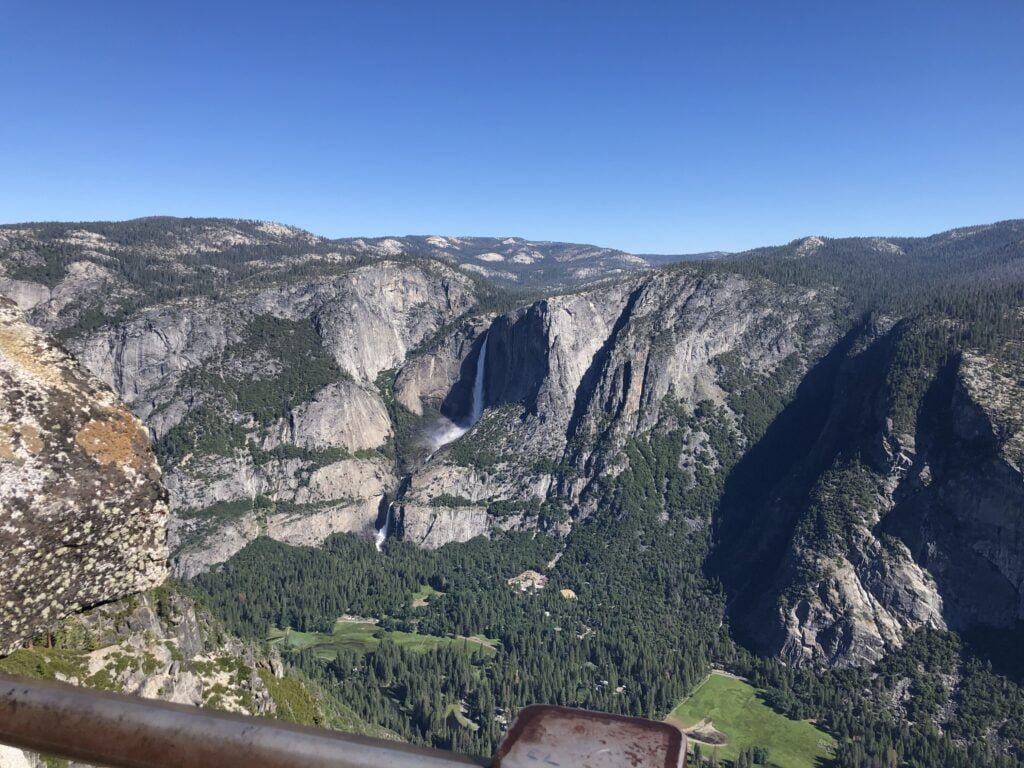
Four Mile Trail – a genuinely amazing hike. Starting from the bottom of the Valley and climbing the Southern wall before making your way to Glacier Point. With views so stunning it is almost hard fathom all the way, you are in for a treat. What makes this trail one of the great ones is the how well maintained it is: despite a near-constant elevation change, the trail is plenty wide, has lots of traction, and never feels as intense as it really is. Allow 7-8 hours for the full loop to allow for time to enjoy the Glacier Point views.
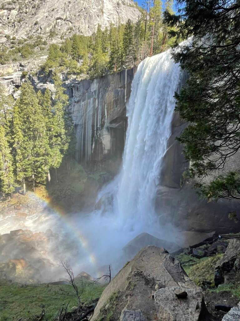
Mist Trail (to Vernal and Nevada Falls) – one of the most popular hikes in the park, this has become my go-to recommendation to the average visitor seeking a decent length hike without going too crazy. The Mist Trail takes off from Happy Isles Nature Center (shuttle stop 16) and heads up an “accessible” section, paved yet steep, to a footbridge a mile uphill, with an amazing view of the majestic Vernal Falls. Continuing onto the true hiking terrain, a series of steep stone steps climbs adjacent to the Falls, spraying hikers with freezing Merced water. A guardrail makes the viewing section at the top safe. From there, a choice: return down or keep going to Nevada Falls, a solid 1.5ish miles upstream. Passing Emerald Pool, which is swimmable in Summer, and crossing another footbridge, a series of steep switchbacks heads up the much more primal, raging Nevada Falls. A surprisingly large, flat rock stands at the top, becoming a frequent stop for lunch or just to sit and enjoy the incredible scenery. The John Muir Trail meets up with it here; either trail is the start of hiking Half Dome. The one thing to note is that you won’t get much solitude; crowds upon crowds flock to this spot.
John Muir Trail (to Clark Point and Nevada Falls) – crowds not your thing? Don’t want to deal with steep, wet steps on the edge of a cliff? Still want to see some incredible waterfalls? Congrats! Here is your alternative to the Mist Trail! The starting leg of an epic, cross-Sierra trail leading all the way to Mt. Whitney in Sequoia/Kings Canyon National Parks, this trail brings you up Vernal and Nevada Falls a longer and less intense way. The trail departs from the same Happy Isles location the Mist Trail does, but branches off about 1 mile in to meander its way up a series of switchbacks to Clark Point, an impressive overview of the valley below and leading to an awesome view of Vernal Falls from on high.
A junction beyond Clark’s Point allows hikers to move over to the Mist Trail or continue the JMT to the top of Nevada Falls, from the Southern side of the waterfall nearer the Panorama Trail. While still a beefy hike that doesn’t get you nearly as close to the falls as the Mist Trail, the rewards of this hike are far fewer crowds, less steep, slippery stairs, and the same incredible waterfalls from a different, and higher, vantage point.
Panorama Trail – 8 mile trail that serves a connector from Glacier Point to Curry Village down below in the valley. For by far the easiest time, descend from Glacier Point; the only incline in this direction is a mile of so going from the Illilouette Falls crossing to the overlook of Nevada Falls. The rest is downhill. The opposite, of course, is true if you start by coming up the Mist/John Muir Trails (which form part of the Panorama Trail) from Curry Village to start; in that case, it’s leg day baby. While spectacular, I don’t find this trail adds to much to either the Glacier Point or Mist Trail experience; seeing Nevada Falls from above is probably the highlight of the section between the two. As amazing a waterfall as Illilouette is, the trail does not run close to the edge.
Lower Yosemite Falls – a wheelchair accessible, short, paved trail leading to the base of the mighty Yosemite Falls. While you can’t see up to the top, it is a great view of the lower falls and during Spring and Summer will cool you off! Just be prepared to enjoy it with 1,000 of your new best friends.
Upper Yosemite Falls – the Stairmaster. Best done in morning or afternoon, as the Sun beams down on the upper half of this steep, rocky, and slippery trail most of the day. Starting with a set of switchbacks leading to a view of the Valley from Columbia Rock, 1 mile up the trail, that is both spectacular and a good spot to stop for hikers seeking a less intense experience. Another mile up the trail takes you to a view of Falls, about halfway up, that is a spot to savor the sheer power of Yosemite Falls and a short branch trail that leads to a view of entirety of the falls. From there to the top, the trail transitions back into a set of switchbacks that seems never ending.
At the top, the signage is a little confusing. The “Overlook” spot leads down a winding path and some scary stairs to the best view from the top, although much of the falls remains hidden. Heading a short distance to the left path towards Yosemite Point to reach Yosemite Creek (surprisingly small!) that feeds the waterfall. It feels great to dip your toes in the cold mountain water, but beware of slick rocks – I almost saw someone slip and fall over the edge while I was up there.
Yosemite Point – from the top of the Yosemite Falls trail, this is an optional add-on that takes you to an amazing vista of the Valley that you will most likely have all to yourself. Worth doing if you already made the effort to climb the Falls!
Valley Loop Trail – A mostly flat, leisurely grand tour of Yosemite Valley. You can pick up and leave the trail at many different points throughout the Valley. This is a great hike if you don’t want to exhaust yourself or just have a couple of hours to spend. It takes you through by the Merced River, in and out of meadows and tall pines, and by the visible waterfalls from the Valley floor. Despite being flat and staying in the Valley proper, this trail never gets the foot traffic that the more well-known hikes do. A nice sleeper pick.
Mirror Lake – best done in Spring/Summer when the lake is full, this is a beautiful little hike tucked in the Northeastern part of the Valley between Half and North Domes. The lake is so named because you can often see the high Valley walls reflected in the lake. The full loop trail tends to get flooded at one section during snowmelt in the Spring, leading to some fun off-roading. Not worth doing once the lake (actually just a slow-moving stream) dries up for the year; a very crowded hike due to being in the Eastern Valley near Curry Village and a flat walk.
Bridalveil Falls – short and sweet stroll up the base of Bridalveil Falls, which can be a nice way to cool off on a hot day. Another waterfall at its best in Spring. This is the waterfall you see from Tunnel View, and the first waterfall you reach when driving into Yosemite Valley from Wawona Road/Tunnel View.
Cook’s Meadow Loop – a nice introduction to Yosemite for people wanting a less strenuous/more relaxing time. This short little loop trail takes you out into the middle of Yosemite Valley, granting stunning views of Yosemite Falls and Half Dome while strolling through meadows. Some nice interpretive signs showcase the evolution of the Valley and human impact on it.
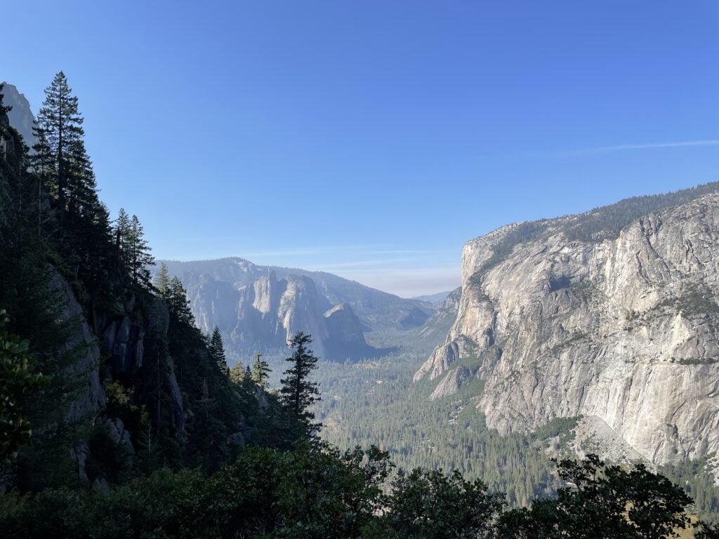
Inspiration Point – the eagle-eyed among us may notice a set of steps at the back of the far parking lot at the famous Tunnel View. Wonder where they lead? They are one terminus of the famed Pohono Trail, which leads from Glacier Point all the way down to Tunnel View over a half marathon in length. If you take the steps up from Tunnel View, Inspiration Point will be the first landmark you reach. Although steep, this is not a long hike and has no real drop-off to add a scare factor. Instead your reward is Tunnel View, but better and without the crowds as you go along.
It should be noted that the viewpoint itself is surprisingly tough to find for three reasons: there is a different spot called Old Inspiration Point off to the side of the trail, and there is no trail markers to designate the spot itself. The last trail marker going up to Inspiration Point is about .5 miles from the spot itself, which is only marked by trail markers to other viewpoints to come. Finally, the viewpoint itself no longer has much of a view of Yosemite Valley due to growth; if you go off to your right, however, for about 100 yards along a well-marked social trail, there is an opening with a breathtaking view of the Valley you can enjoy all to yourself.
Off Of Glacier Point Road
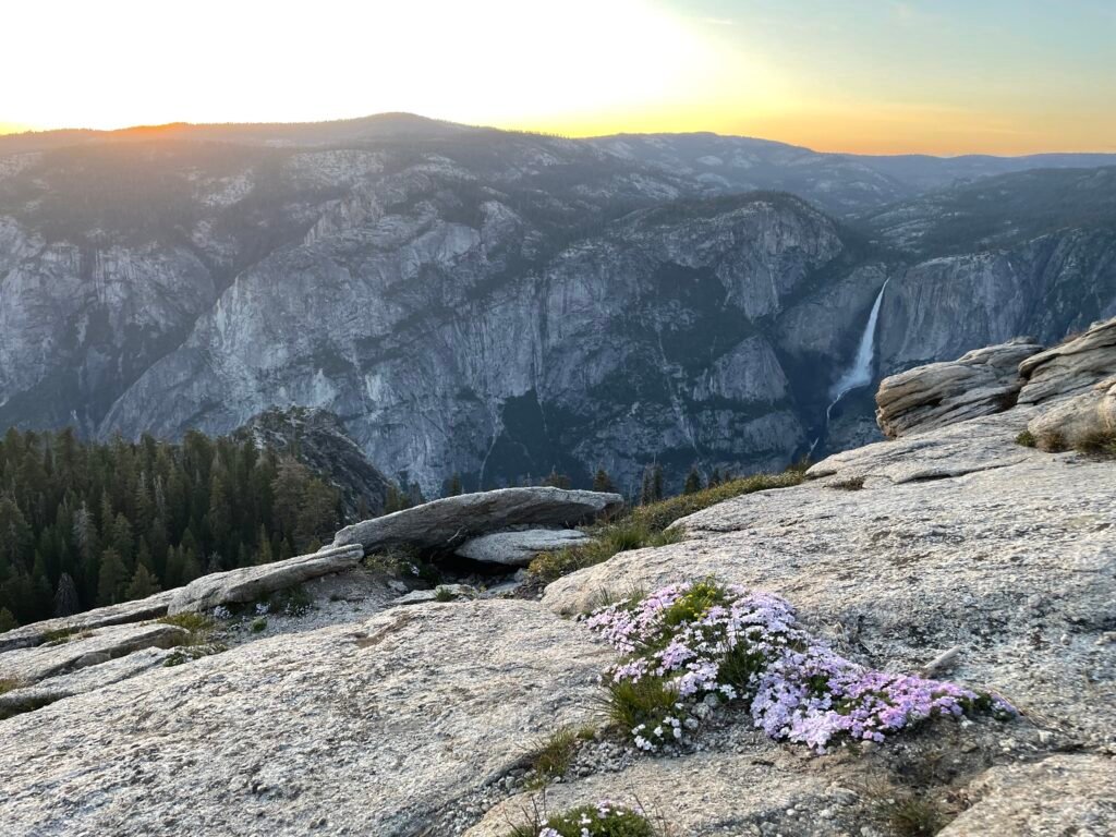
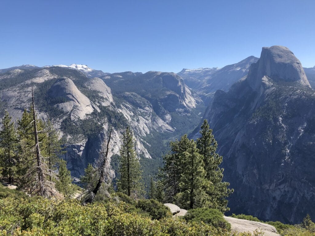
Glacier Point -The star of the show; the reason this road exists. Quite simply, one of the best views you will ever see. The majesty of Half Dome, the roar of Yosemite Falls, and towering peaks of the Clark Range all in one incredible panorama. You will never want to leave. It gets very crowded, especially in the midday and at sunset, but parking is rarely a major issue. This is a favorite stargazing spot of mine for how open it is; just pack many layers, even in Summer, as it gets very cold.
Sentinel Dome/Taft Point -Two amazing views of Yosemite Valley for the price of one. Taft Point overlooks the Western Valley, whereas Sentinel Dome gives you a grand view of the Eastern Valley + Half Dome. Both give you views equal to the grandeur of Glacier Point (which you can drive right to) with just a fraction of the crowd.
Ostrander Lake – A little gem that attracts only hardy hikers, this behemoth of a day trip is more commonly done as part of a backpacking route. Starting off Glacier Point road, a lovely route takes you first through a tranquil forest, where streams and wildflowers abound. Then the trees thin and a slow, gradual climb over rocky terrain takes you to the base of the challenging part of the hike: the final 2 miles uphill, first across open terrain where the Sun bakes you and then through another forest. The reward for you (and your weary limbs) is Ostrander Lake: a medium-sized, swimmable glacial lake that will never be crowded. It is also the sight of a skier’s cabin used in the Winter.
Mono Meadow – one of several meadow hikes along Glacier Point Road, this neat hike takes guests down from the parking area (it is marked and about halfway up Glacier Point Road) to a very large, very marshy meadow at the base of a gully. Best seen during the wildflower bloom in early Summer. There is some elevation gain here; the way back up will have you sweating a little bit.
If you so choose, this trail continues onward through the far side of the meadow for another couple of miles, where an overlook of the Clark Range comes into view and the trail eventually meets with the Illilouette Creek.
McGurk Meadow – a lesser known hike that passes a historic cabin (lived in briefly by, you guessed it, McGurk!) and crosses a large meadow. Not a name-brand hike, but a pleasant and crowd-free way to spend an afternoon meandering about a pristine meadow. Entering the meadow is dream-like, as you cross a bridge over a small creek and then are amongst the reeds and flowers. If you continue beyond the meadow, the trail will eventually reach Bridalveil Creek and the Pohono Trail.
Mariposa Grove/Wawona
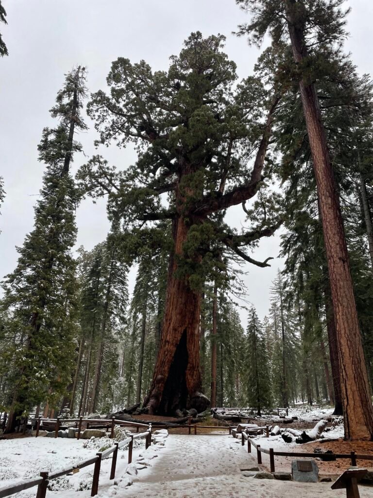
Grizzly Giant Loop – The most popular trail in the Mariposa Grove of Giant Sequoias. This takes you to plenty of heavy hitters: the largest tree (by volume, not height!) in the park, the Grizzly Giant, foremost. This bad boy has seen some sh*t in his day: he is over 1,800 years old and still racking up the years. Also of note are the Bachelor and 3 Graces: 4 closely chilling sequoias, as well as the California Tunnel Tree, a tree that got hollowed out by the park in a different time, hilariously not learning the lesson of another tree they hallowed out to drive through and then died. This trail looks quite a bit different than it did just a decade ago: a road has been removed to restore the grove to a more natural appearance, only for recent wildfires to ravage a lot of the landscape. The scars are very evident, but the trees are still spectacular.
Mariposa Grove Trail – the best trail in the Grove; takes guests along the old road route up past Grizzly Giant to the Upper Grove, where the real magic happens. Away from the crowds are surrounded by many more sequoia’s, this is a showstopper. The top of the trail leads past some famous sticks – the Ansel Adams Tree and the late, lamented Wawona Tunnel Tree – on its way up to Wawona Point, a breathtaking view of the Wawona Valley, meadow, and even, yes, the infamous golf course. The best part? So few people actually bother going to the Upper Grove, making this a great place to find some solitude.
Guardians Loop Trail – the alternative trail in Upper Mariposa Grove. Accessed the same way at the Mariposa Grove Trail in the Upper Grove, by continuing beyond the Grizzly Giant. The trail starts at a bathroom near the Galen Clark Cabin, branching off toward the right (and the cabin) whilst the Mariposa Grove Trail continues straight. This quieter trail has less well-known sequoia trees than other Grove trails, but the abundance of them, as well as how close the trail skirts by these giants, makes up for that. Highlights include the infamous Fallen Tunnel Tree, a monument to a different time where man’s folly carving a hole in the center of this tree eventually caused its demise in the name of tourism, and the Galen Clark Tree, most well known for featuring in an iconic black-and-white photograph of Yosemite’s first Guardian, Galen Clark, standing in front of it.
Chilnualna Falls – the Big One amongst the Southern Yosemite hikes. A waterfall hike that almost mirrors in elevation change and length the Upper Yosemite Falls trail. Yes, it has stairs as well! The trail takes you close to the lower falls, so that within the first 20 minutes you can find some neat swimming pools. Most of the middle portion takes place away from the cascades and meanders up the cliff to the left of the falls before returning for the showstopping upper falls. This is a tough, challenging hike for most people, but this is your best chance to experience a massive Yosemite waterfall without the crowds.
The best time hike? Depends on what you are looking for. The falls roar in Springtime, but the mosquitos can be brutal. Summer brings wildflowers, but also rattlesnakes and heat. Late Summer/early Fall is the best time to swim (and some spots open up at the upper cascades, but be careful!), but the falls will be at their lowest.
Swinging Bridge Trail – A hidden gem, this trail goes off the beaten path in Wawona. The Swinging Bridge, which certainly lives up to its name, is accessed by one of two trails. You can reach the bridge from a 0.3 mile trail, parking at the end of Forest Road, but the far superior option is the 0.7 mile trail from the end of the dirt road that continues from the end of Chilnualna Falls Rd. Taking you from a beautiful waterfall into some lovely meadow and wooded areas, you end up at the peaceful Swinging Bridge, with breathtaking views of a roaring river (the East Merced) beneath you, lovely tall pines, and mountains off in the distance. Best seen at dusk. Not at all needed for a full trip to Yosemite, but if you spend a multiple evenings in Wawona, do this late one afternoon.
Wawona Meadows Loop – a casual 3 mile stroll around woods, meadows, streams, and even the (in)famous Wawona Golf Course. Pick up the trail from the Wawona Hotel. Best done in morning or at night to enjoy the serenity and more animal activity.
Washburn Trail – a cool little nature trail that leads from the back of the Mariposa Grove welcome center to the grove itself. An alternative to the shuttle bus during the season and needed during offseason to access the grove, it is a pleasant, if somewhat forgettable stroll by Yosemite’s high standards. The highlights come early: a neat bridge among some massive trees crossing a lovely stream, and a hillside brush section with lots of Manzanita.
Alder Creek – this is one for those who need solitude in their hiking. One of the most desolate day hikes in the park, this trail picks up in Wawona just before the schoolhouse, or can be shortened by 2 miles by parking at the big U-shaped curve on the road at Mosquito Creek. This is mostly a nature walk – pretty forests, small creeks, the occasional patch of wildflowers – until it reaches Alder Creek Falls, the end point and high point of the excursion. While not as spectacular as other waterfalls in the park, it still packs a punch (over 100 feet) and you can sit here for an hour and not see another soul.
Tioga Road/Tuolumne Meadows
Glen Aulin – an elite (and mostly flat!) hike that packs a lot of what makes the High Sierra’s incredible into one stroll. Starting out at the incredible Tuolumne Meadows, it ventures out to several meadows and open rocky sections alongside the Tuolumne River. Towards the end of hike, things get rocky and you maneuver down a series of steps alongside several cascades to Glen Aulin itself, a beautiful waterfall with a rocky swimming pool underneath. As a bonus, a High Sierra Camp is next to the falls and the entire trail is apart of the Pacific Crest Trail. Continuing on down the trail would take you to Waterwheel Falls, a day hike only feasible for the fastest hikers.
Tuolumne Meadows to Soda Springs/Parsons Lodge – as short and idyllic a walk as you could imagine, taking you through breathtaking High Sierra meadow abounding with rivers, wildflowers, and wildlife to go with an alpine backdrop. Completely flat and accessible for most people, it takes one through the meadow to a natural water spring and an old Sierra Club meeting place/cabin. Recommended for one-day visitors to this part of the park. A sunset here will be a memory for a lifetime.
Elizabeth Lake – my recommendation for hikers looking to experience the High Country for the first time while figuring out the limits of their lungs with the high altitude. The first mile of this trail, which begins near the Tuolumne Meadows Visitor Center, is steep and will have those who aren’t used to altitude struggling for air. The reward is a largely flat last mile to the lake, which, as with all alpine lakes in this section of Yosemite, is an absolute feast for the eyes. A clear lake with an odd shape is surrounded by a meadow and cliffs on the far side; a social trail takes you all around the lake. This hike is fairly popular, but the crowds are a fraction of those in Yosemite Valley.
Clouds Rest – an action-packed, difficult hike that takes one to the top of an iconic peak, staring DOWN at Half Dome 1,000 feet below you and Yosemite Valley a whopping 5,000 down. Your lungs and legs will hurt for this view, but it is one you will never forget (and, consensus says beats the view from Half Dome!) There are two ways to reach the peak, the one starting at Tenaya Lake being the “easiest.” Bring a ton of water – water sources are few and far between later in the Summer, and it is quite the workout in the middle section of the hike where you face down a 1.5 mile stairway to heaven that feels like it will never end. The hike really comes together in the last 2 miles, with epic views of the Merced River Canyon before reaching the top of the knife’s edge-esque Clouds Rest. On a cloudy day, you will literally be amongst the clouds here. You are that high up. Savor every last second – you earned it!
The alternative, tougher route is a 20-mile behemoth starting at Happy Isles Trailhead in Yosemite Valley, taking either the Mist or John Muir trails to the top of Nevada Falls, following the trail towards Half Dome before branching off toward Clouds Rest instead.
Cathedral Lakes (Upper and Lower) – a beefier hike starting at the Tuolumne Meadows visitor center and going up to two incredible alpine lakes (aptly and lamely named Upper and Lower Cathedral Lake, respectively). Upper Cathedral Lake overlooks Tenaya Lake down below, an incredible sight. The trail is difficult early on – a series of switchbacks jacks the elevation up by 1,000 more feet – before flattening out for several miles that takes you past several smaller granite domes. A fork in the road near the end of the trail(s) forces you to make a decision: continue to the right to the Lower lake, or left to the steeper, Upper lake. Both are an additional one mile from the fork, with Lower being flat and Upper being quite the workout. Of course, you could tack on both by backtracking.
Dog Lake & Lembert Dome – pairing these two hikes together, because they are right in the same vicinity at the eastern edge of Tuolumne Meadows. The layout gets interesting, so bear with me as I try to explain. Each can be done as an out-and-back or a loop hike by going through parking areas. The official Dog Lake parking is just off Tioga Road by Lembert Dome (confused yet?!) The Lembert Dome parking is separate, next to the Tuolumne Meadows Lodge. Both parking lots provide the shortest route to each destination, but from Dog Lake to Lembert Dome is just an addition mile, making it worth packing both in if you are capable. By going up the Dog Lake side then down the Lembert Dome side to the parking lot and making it a loop back to Dog Lake parking, you will even hike a small chunk of the PCT! Consult the trail maps ahead of time.
As with all hikes at this elevation, altitude will affect most hikers and wear them out, especially on the uphill’s. Both hikes start off with significant uphill’s before flattening out as they near their respective destinations. Dog Lake is another beautiful lake, with a nice backdrop of 3 mountains in the background. The little inlet to the left of trail’s end is a peaceful place to spend an hour. Lembert Dome, meanwhile, provides one of the best views anywhere in the park. Not for those scared of heights or that have vertigo, the trail leads you right out onto the exposed granite overlooking Tuolumne Meadows, where you get to pick your own path. This can be an exhilarating or terrifying moment depending on your comfort level; the view more than makes up for it.
Pothole Dome – The lesser known but more accessible of the granite domes that flank Tuolumne Meadows. Parking is found right off Tioga Road next to the dome, and then a trail takes you around the base of the dome before leading onto it. It then is up to you to find the best way to the top, where stunning views of the Meadows unfold below you. As a nice bonus, the trail opens up to a river at the East edge of the Meadows if you carry on around the base of the dome instead of ascending.
Gaylor Lakes – the closest hike to an edge of the park (mere feet inside the Tioga Pass entrance), Gaylor is a short hike that really should be better known. Perhaps because of the steep climb, perhaps because of the elevation, or perhaps because everyone rushes to the Valley, it remains delightfully empty. When I hiked this trail, I had the namesake lake all to myself for nearly an hour, making a mile-long lap around the lake and taking a cold, crisp dip to boot. The lake itself is different to a lot of the other High Sierra lakes, in that it sits in a largely open expanse of land as opposed to sitting in a bowl. This makes for a unique experience and a good launching point to hike to other peaks in the area, including other alpine lakes and an old silver mine. If you are okay with some serious altitude (topping out at over 10,000 feet above sea level), I can’t recommend it enough. Not only do you get to hang at an unique, quiet lake, you also get incredible views of Dana Meadows and Mt. Dana from on high at the crest of the trail.
Tenaya Lake – not just a lake, but also a trail! To be perfectly honest, however, the trail does not do this mini-Lake Tahoe justice. It skirts the shaded side of the lake and fails to provide much in terms of panoramic views, just taking hikers from one beach to the other on opposite sides of the lake. I’d say stick to the beach and swimming here; if you need to hike from here, there are more interesting trails that begin at Tenaya Lake and branch off towards the Valley or Tuolumne areas. You can also complete a loop around the lake if you are willing to walk the area beside the Tioga Road for a stretch.
Mount Dana – from right next to the Tioga Road entrance, climb the second highest peak in Yosemite – over 13,000 feet! It should be noted that, as an unofficial trail, there is not much in the way of signage so downloading an All Trails route or similar ahead of time is extremely helpful. That said, the trail is easy to follow for the most part, and when the trail becomes all rock at the end, plenty of cairns guide the way. This is an advanced trail that should only be attempted by people in extremely good shape. Not only does it go straight up a mountain, it starts at 10,000 feet and then climbs a further 3,000 – altitude sickness is very common on this trail. It is punishing – especially at the last half mile, as you are climbing loose rock to the top. Your reward? Quite simply, a view beyond belief. It remains the finest view I have ever seen in my life. To the East lies the massive saltwater Mono Lake, the deserts of Nevada beyond. Looking North and South gives you endless mountain peaks, many piercing blue lakes, and even several surviving glaciers. To the West, the meadows of Dana and Tuolumne astound from on high. I would not recommend attempting it without building up to it, but Mount Dana is an all-time hike. Be careful on the descent -the rocks can slide out from under you with shocking ease.
Hetch Hetchy
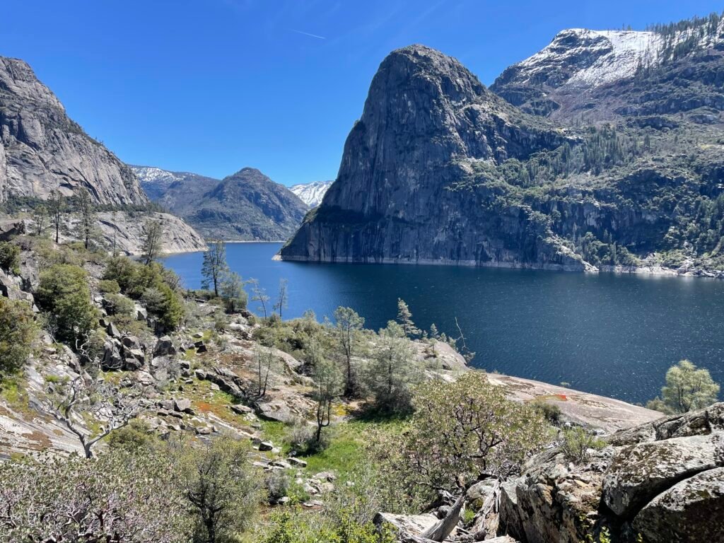
Wapama Falls – With the main attraction buried 500 feet underwater, my expectations going to Hetch Hetchy were low. I fully expected to be forlorn at the lost beauty of the place. You know what? Dam it, it’s still an incredible place. By no means does the reservoir enhance the place, but Hetch Hetchy is so incredible it still has the power to overwhelm even with its valley long-lost. This is the hottest section of the park accessible by car, and there is little shade, so I recommend visiting in Spring/Fall. A hike to Wapama takes guests first across the dam, where you can get a good sense as to how high they built it by peering over the edge to the Tuolumne River continuing far below. Next one passes through a dark tunnel to the real good stuff. In Spring, hikers cross several streams and smaller waterfalls (including the very neat Tueeulala Falls) on the way to Wapama Falls, the end of the hike. Man, Wapama is an impressive sight at full blast, even missing its final 400 feet. I got drenched standing at one of the many footbridges crossing the falls, as its disperses across rocky cliffs in its final descent to the water. Just an awesome sight, and a reminder nature can still pull punches despite man’s best attempts to thwart it.
Big-Name Hikes I haven’t done
Half-Dome – The mother of all National Park day hikes, this behemoth requires a reservation just to attempt to climb it. Reservations sell out within minutes for the entire year on the day they are released. Not for the faint of heart: by all accounts don’t do if you are scared of heights or aren’t in very good shape. It takes all day, out in the heat, climbing about 5,000 feet from start to finish. The cables, for the 45-degree climb near the end, go up late Spring and are taken down at the beginning of October.
National Park Rankings
- Yosemite National Park
- Olympic National Park
- Mount Rainier National Park
- Kings Canyon National Park
- Zion National Park
- Bryce Canyon National Park
- Arches National Park
- Canyonlands National Park
- Crater Lake National Park
- Indiana Dunes National Park
- Shenandoah National Park
- Capitol Reef National Park
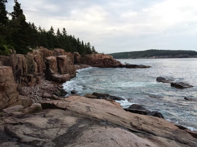
- Acadia National Park
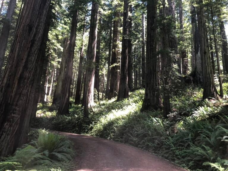
- Redwood National Park
- Pinnacles National Park
- Cuyahoga Valley National Park
- Gateway Arch National Park
A note: as with all reviews to come, this will be updated upon any re-visit to the park. Feel free to comment or send in your own reviews or recommendations and we will get it added here!
Great tips on Yosemite. If I did not know better, I would say you already started your new position. You are going to Love it!
Thanks – I’m starting to get excited!