The second national park near Moab is more remote and mysterious. It’s time to chat Canyonlands!
What is it?
Mars on Earth.
Fast Facts:
Location: Southeast Utah, outside Moab
Founded: 1964
Size: 527.50 square miles
Cost: $30/car; $55/year1 (Just buy the $80 America the Beautiful pass if it is in your budget – full access to every national park for a year)
Visited: 2023
The Ridley Review:
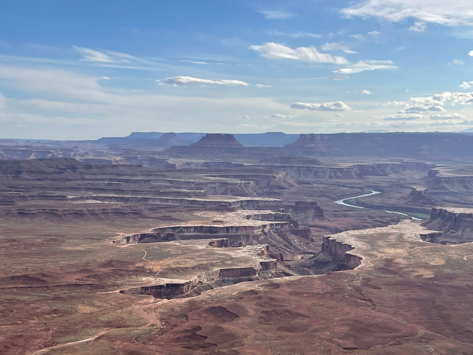
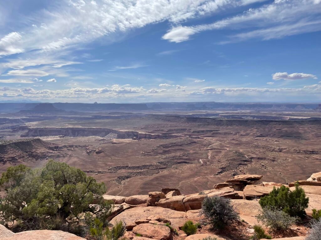
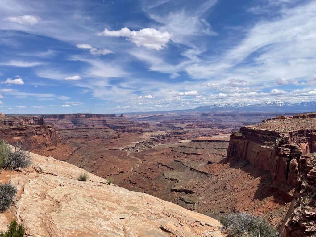
A trip to Canyonlands is a lot like I imagine seeing a UFO would feel like. The brain simply does not know how to comprehend what it is seeing. The landscape is weird, man. The best way I can describe it is feels like the Earth has been cut into layers without any pattern.
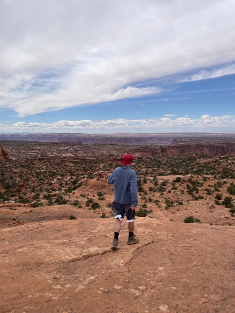
In reality, it’s just the Colorado and Green Rivers and erosion doing work over thousands of years. Said rivers also divide this park into 3 distinct parts: the Island in the Sky, the Needles District, and the Maze. See “layout” below for more information on each. I was only able to spend a day exploring the Island in the Sky, which more than lives up to the hype. It has a surreal factor that neighboring Arches doesn’t have, but the tradeoff is that you feel far away from the action. From the plateau that comprises the Island in the Sky, you are treated to many incredible vistas, but without a 4 wheel drive vehicle, you can’t get close to the ground and the rivers.
To do Canyonlands justice requires a full week and 4 wheel drive; this enables you to go down into canyons otherwise not accessible and is the only way, besides hiking in, to explore the rarely-visited Maze section. With just one day, I recommend the Island in the Sky and if you have two days, tack on a trip to the Needles.
The Layout
3 distinct districts with separate entrances, divided by canyons through which the Colorado and Green Rivers flow.
The Island in the Sky is the most popular and most developed section, housing the main visitor center and the Overlook Road. The visitor center houses the only water available in this section of park. The Overlook Road takes you to several grand overlooks and eventually splits into two, allowing for additional access to points of interest.
The Needles has more diverse but less spectacular scenery. There is a separate, paved entrance. Here you find a seasonal visitor center (and water – again the only water in this section of the park) and a plethora of things to see. The district is named after Needles, rock spire that stick out of the ground in a somewhat-similar manner to the Hoodoos in Bryce Canyon. There are also arches to explore, meadows, and some ancient Petroglyphs left behind by Native Americans.
The Maze is true wilderness. Only accessible by unpaved road, only a few hearty visitors enter this barren stretch of land every year. Some say it is one of the most remote areas in the contiguous 48 states. Your reward for your endeavors is the total freedom (and dangers) of exploration: there are no amenities and few marked trails in this section, meaning navigation is paramount.
Transportation
No matter what section of the park you visit, you need a car. No public transportation exists to or inside the park. The Needles and Island in the Sky are accessible without 4 wheel drive, but 4WD gains you access to additional roads that get closer to points of interest. 4×4 is necessary to enter the Maze.
Activities
Besides hiking and backpacking in the backcountry, 4×4 off-roading and river rafting trips are cool things to do.
Roads and Gas
Two paved roads into the park, one to enter Island in the Sky and the other the Needles. I will provide directions from Moab, the most common hub for visiting Canyonlands.
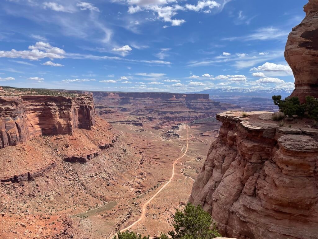
For Island in the Sky, the drive takes about 45 minutes. Head North along State Route 191 out of Moab until you reach an intersection with highway 313. Turn left (there will be a sign for Island in the Sky to help) at the intersection and then drive straight for half an hour or so until you reach the park entrance station. Once in the park, you will first reach the visitor center. After loading up on water, the road continues for 6 miles before reaching a fork: to the right takes you to Upheaval Dome (a further 5 miles) and a small offshoot road that leads to Green River Overlook (easy to miss, comes right after the fork). To the left, the road travels to Buck Canyon Overlook and ends at Grand View Point Overlook a further 6 miles from the fork.
For the Needles, the drive takes about 90 minutes from Moab, although only one hour coming North from Monticello. Head South on State Route 191 from Moab. Turn right onto Highway 211, and take that to the entrance station. You will first reach the visitor center. Beyond that, the main road winds through the Needles until it ends at Big Spring Canyon Overlook. Branch roads, such as the ones to Cave Spring and Elephant Hill, start off paved but become unpaved before reaching the destination. The main campground in the Needles is accessible off a branch road.
There is no gas in the park – load up beforehand at a town such as Monticello or Moab.
Rating:
Like nowhere else I’ve ever seen. All the Utah parks are great, and this probably sits in the middle. Best done as an immersive trip deep into the wilds.
Food & Lodging
Food
No food. Pack food for trip.
Lodging
Hotels
Zero.
Camping
Island in the Sky Campground – strictly first-come, first-serve for $15/night. No amenities besides trash collection. Located along the Green River Overlook branch road, on the right-hand side of the forked main road.
Needles Campground – some sites are first-come, first-serve, others can be reserved up to 6 months out. Cost is $20/night, with seasonal water supply and trash collection. To reach, take the main Needles road and follow the signs; you will take the third left to reach, and then a right when the road forks.
Loads of backcountry options in all 3 districts of the park.
Hikes and attractions:
Hikes
Island in the Sky
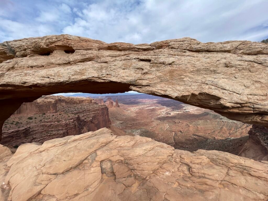
Mesa Arch – Short and sweet, this easy trail takes you to one of the park’s most famous features: Mesa Arch. The sun rises right through it, making it a famous spot for photos. That it is so easily reached makes it very popular – prepare to wait to have your turn to take a pic or soak in the incredible view of the desert floor thousands of feet below.
Upheaval Dome – at the far right end of the forked road sits the trailhead. Upheaval Dome is a very different landscape to the rest of Island in the Sky, making this a worthwhile trip. It does get somewhat difficult in parts – the trail isn’t always marked the best and there is some minor hiking over rocks. There is the option to stop at the first overlook point, which is just 1.2 miles out and back. The second has the better views, so I recommend doing the whole trail.
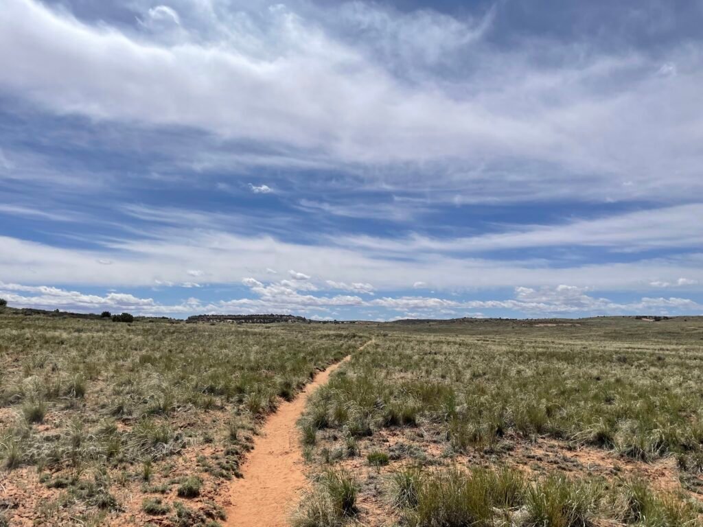
Lathrop Trail – now THIS is a trail. A little-known trail that I only did part of because a ranger recommended it to me, this is an amazing way to escape the crowds while still experiencing the rim of Island in the Sky. Seriously: I think I encountered fewer than 20 people the entire stretch of trail I did. Starting at a sandy, grassy flat field, you eventually take to rocks, where cairns provide your source of navigation. The sand adds some challenge and on a hot day will be very difficult – bring lots of water. This will take you to Canyon Rim, a breathtaking overlook of the canyon below. I spent an incredible half hour eating lunch right at the edge and encountered no one. There is an option to continue on down into the canyon, which takes you all the way to the unpaved, 4WD-only White Rim Road.
Grand View Point Overlook Trail – not sure why “viewpoint” is two words here but alas here we are. A popular, but stunning trail that takes you out-and-back along Grand View Point, with my favorite views of the canyon lands (I can play the two-word game too!) below. A must-do, and despite hugging the cliff, is not a difficult hike unless you have vertigo, in which I case recommend staying at the fenced-in overlooks by the parking lot.
Skyline Arch Trail – I don’t recommend this one. You get just as good of a view from the road – the trail only takes you to the base of the rock formation the arch sits on, so you don’t get much of a view.
Other Well-Regarded Hikes (That I haven’t Done)
Island in the Sky
Gooseberry Canyon – trailhead located a picnic area 1.0 north of Grand View Point on the left-hand branch of the main road. The steepest trail descending into the canyon, this soul-fulfilling and calf-destroying hike goes 4.6 miles down-and-back into the canyon, ending at the White Rim Road.
Needles
Cave Spring Trail – now this is a fun one; ladder-climbing is involved! To reach the old cowboy camp and ancient petroglyphs, a little climbing is needed that puts a little challenge in this otherwise easy, 0.6 mile trail.
Chesler Park Viewpoint – a good overview of the diverse scenery in the Needles. More of a strenuous hike, it clocks out at 5.8 miles
Maze
Maze Overlook – more rock climbing than hiking, this 1.0 mile strenuous trail provides a grand view of the Maze district. Per NPS, “A 25-foot (7.6 m) length of rope is often necessary to raise and lower packs in difficult spots. Basic climbing maneuvers are required to negotiate steep slickrock and pour offs”2
Other Activities
4×4 exploring requires a permit; the Maze district is notoriously difficult to navigate without a hefty chuck of skill. Rafting trips all start outside the park and there are private shuttle services that can take a group back to Moab after a trip. More details available here.
National Park Rankings
- Yosemite National Park
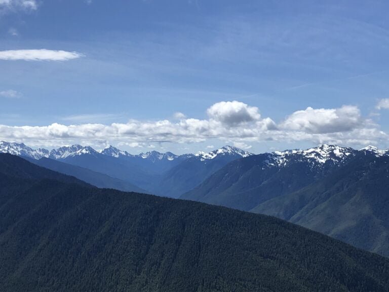
- Olympic National Park
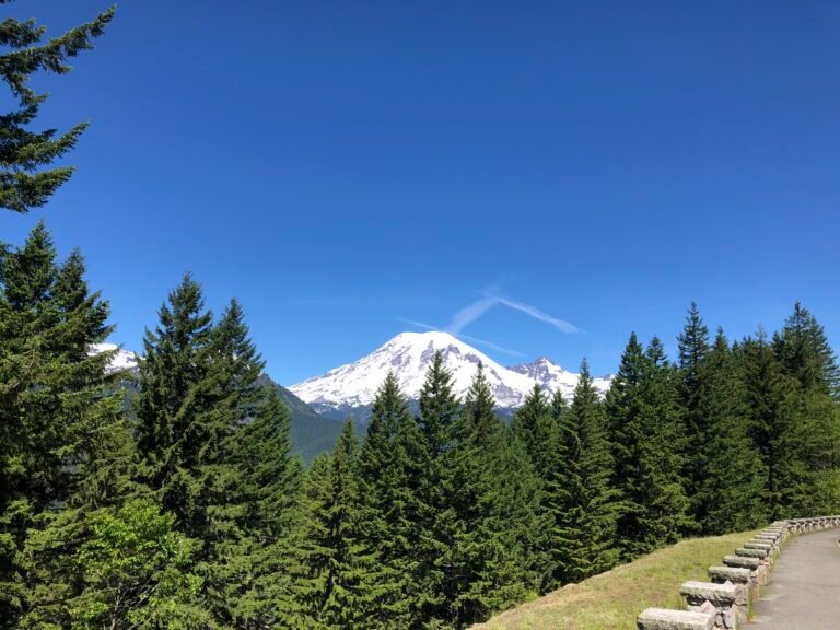
- Mount Rainier National Park
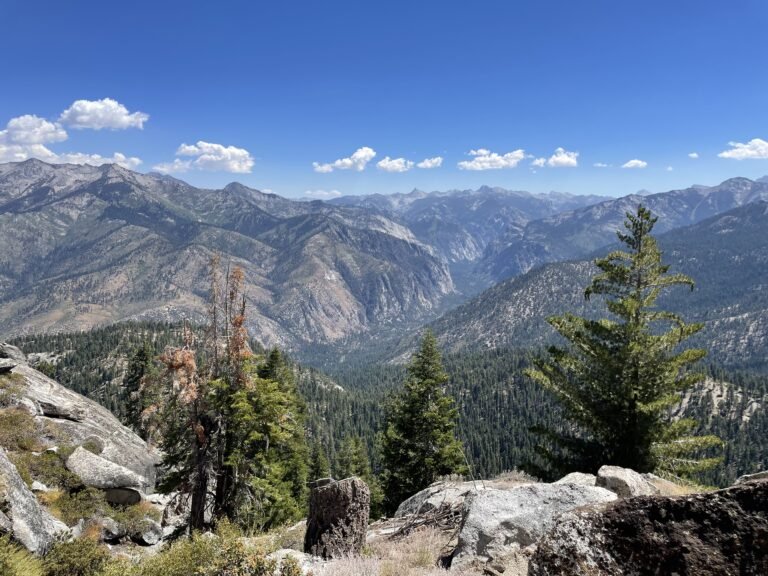
- Kings Canyon National Park
- Zion National Park
- Bryce Canyon National Park
- Arches National Park
- Canyonlands National Park
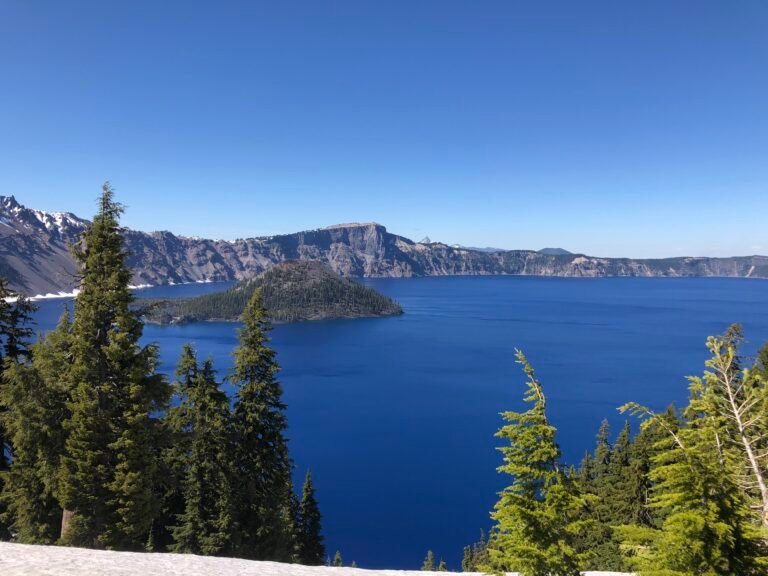
- Crater Lake National Park
- Indiana Dunes National Park
- Shenandoah National Park
- Capitol Reef National Park
- Acadia National Park
- Redwood National Park
- Pinnacles National Park
- Cuyahoga Valley National Park
- Gateway Arch National Park
A note: as with all reviews to come, this will be updated upon any re-visit to the park. Feel free to comment or send in your own reviews or recommendations and we will get it added here!